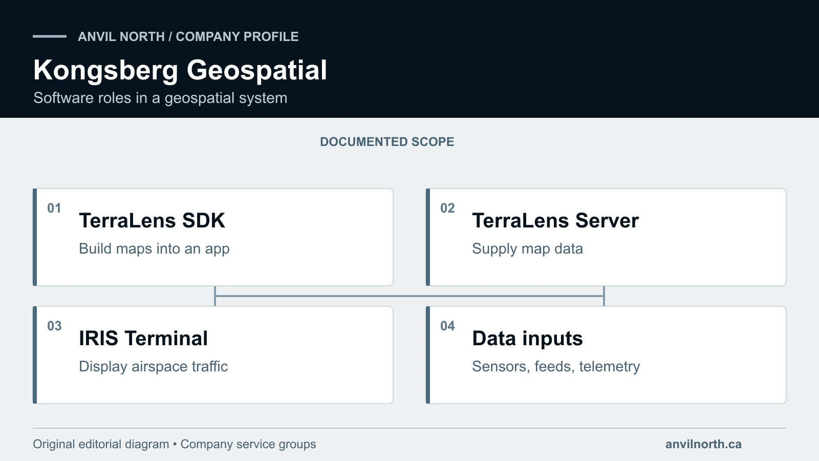
Kongsberg Geospatial makes software for live maps, geospatial displays and airspace awareness. The Kanata, Ontario, firm offers tools for software teams and products for operators. Its range includes TerraLens, TerraLens Server and IRIS Terminal airspace software. These products help build displays, supply map data or show aircraft and surrounding airspace.
What does Kongsberg Geospatial do?
Kongsberg Geospatial’s website describes mapping software for defence, aviation and other uses. Its products help users display maps, tracks, terrain and related data. The firm identifies itself as part of Kongsberg Defence & Aerospace.
Other Kongsberg businesses sell products that serve different markets and tasks. This profile covers the Canadian software firm and its own product range. Maritime systems and other group contracts need attribution to the business that holds them.
Mapping software also serves a different role from physical sensors and electronics. Aversan’s electronics engineering services cover another part of the system’s design needs. A map display needs clear interfaces to receive data from its sources.
How do TerraLens, TerraLens Server and IRIS Terminal differ?
TerraLens is a software development kit, or SDK, for building geospatial applications. It supports 2D and 3D displays, terrain and layers of map data. Software teams use those tools within the apps they build for their users.
TerraLens Server supplies map tiles and other content to software that displays it. The firm lists support for raster, vector and terrain data. It also describes Web Map Tile Service support for clients that use that standard.
| Product | Documented role | Main user requirement |
|---|---|---|
| TerraLens SDK | Toolkit for geospatial application development | Build mapping and display functions into an application |
| TerraLens Server | Server for map tiles and related geospatial content | Deliver data to supported client applications |
| IRIS Terminal | Airspace visualization using multiple information sources | Present operational traffic and airspace information |
IRIS Terminal brings sensor data, other feeds and aircraft telemetry into an airspace display. The firm describes uses by drone operators and test-range teams. The screen helps them track aircraft and understand the surrounding airspace.
Each product meets a different need within a software project. A team building an app may want tools for its own code. An operator may need a working display, while a server supplies its map content.
What does airspace visualization support?
An airspace display helps an operator see aircraft and other relevant data. Kongsberg Geospatial describes IRIS Terminal tools for conflict warnings and different data inputs. What the screen can show depends on those feeds and their connection to the system.
The firm discusses beyond-visual-line-of-sight flight, or BVLOS, as a use for its software. That describes how an airspace display can support an operator’s work. It does not show approval for any given customer’s planned flight.
These roles differ across Canada’s aircraft and aerospace supplier base. An aircraft, sensor, data link and display each perform separate tasks. Buyers should identify the tools they need and how each part will connect.
What should a geospatial-software enquiry specify?
State who will use the software and what data it must display. Explain whether the project needs development tools or an existing product. Include the expected workload, network conditions and hardware planned for use.
| Requirement | Information to provide | Decision it supports |
|---|---|---|
| Development scope | Existing application, language and operating system | Toolkit integration |
| Map content | Raster, vector, terrain and required formats | Data preparation and delivery |
| Operational inputs | Sensors, feeds and telemetry interfaces | Supported information sources |
| Display workload | Tracks, layers and update requirements | Performance assessment |
| Deployment | Network constraints and user locations | System architecture and support |
Kongsberg Geospatial publishes TerraLens specifications that include language and OS support. These include C++, Java and C#, with Windows, Linux and Android options. Test the intended data and hardware to assess how the chosen setup performs.
Kongsberg Geospatial: common questions
Where is Kongsberg Geospatial located in Canada?
Kongsberg Geospatial works in Kanata, Ontario, within the Ottawa technology region. The firm makes mapping and airspace software for developers and operators. Its products serve different roles, from building displays to showing live aircraft data. Use the full business name to distinguish this Canadian operation from other Kongsberg firms and their product ranges.
Is TerraLens a finished mapping application?
TerraLens is an SDK that software teams use to build mapping apps. It provides map and display tools within a larger piece of software. The customer still needs to define the tasks and screens its users require. Kongsberg Geospatial offers other products with separate roles, so a buyer should distinguish an SDK from a complete app.
What is the difference between TerraLens and TerraLens Server?
TerraLens gives developers tools for showing maps and other geospatial data. TerraLens Server supplies map content to the software that needs to display it. The two products can therefore fill different roles within one system. Explain what users need to see and how the software will receive the data for that view.
What does IRIS Terminal do for drone operators?
IRIS Terminal shows airspace data from the sensors and feeds linked to it. Kongsberg Geospatial describes aircraft tracking and conflict warnings for drone operators and test ranges. These tools help a team understand the traffic around its work area. The actual view depends on the selected data sources, their coverage and how the system connects them.
Does IRIS Terminal’s BVLOS description establish flight approval?
IRIS Terminal’s BVLOS description explains a possible use for its airspace display. It does not grant approval for a customer’s single flight plan. Software tools and evidence for a flight operation remain separate matters. The operator must define the mission and check which product features and records support its review of that flight.
How should buyers compare Kongsberg Geospatial with other suppliers?
Kongsberg Geospatial comparisons should start with the mapping or airspace software task. The Canadian supplier directory covers firms that supply other parts of an aircraft system. A sensor maker and a mapping software team provide different products and services. Define the data, interfaces and work needed before deciding which suppliers belong on the same shortlist.
Follow Anvil North Weekly for news on Canadian defence software and aerospace firms. Each edition connects supplier developments to their sources and wider program context.
Sources
- Kongsberg Geospatial
- TerraLens development toolkit
- TerraLens Server
- IRIS Terminal
- TerraLens technical specifications
Earlier identity and portfolio references retained from the 13 September profile review: